Presenters
Northville Central School
Currently a 6/7 Grade Science teacher as well as a Teacher Leader focusing on STEM. I am also filling the role as a part-time Instructional Coach for our district.
Northville Central School
Northville Central School
Northville Central School
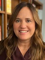
Jamie Groff Dickinson is a High School Earth and Environmental Science Teacher. She has been creating her own NYSSLS aligned Project Based Learning Units for over 8 years. She has presented on PBL and technology at the 2016 Model Schools conference in Orlando, FL and several times at the STANYS annual conference in NYS. She is an ISTE Certified Educator and is a member of the Teach OSM Educator Working Group. She is an avid OSM mapper and a coach for her school's Esports Team.
Session description
See how earth science students used satellite imagery and OSM to determine areas that are missing from the map and at risk for earthquakes. Students were tasked with creating a 2- to 5-minute pitch to win a mock micro-grant. Students then added the missing information to the map to improve disaster responses.
Purpose & objective
Participants will brainstorm ideas to use Open Street Mapping in subjects other than Geography. Teachers can see first hand how students can answer and investigate questions like the one posed with hands-on mapping projects in their local and global community. This project is aligned with both NGSS standards as well as ISTE standards. This project was recognized by Teach OSM as a way to engage teachers other than Geography in Open Street Mapping. Students only need a chromebook and an account to access Open Street Mapping. Teachers have full control over student edits and best of all, it is free!
More [+]
Outline
Students will be presenting their video pitch, how to use Open Street Mapping and what they learned through the process. They will share their portfolio as well as pictures of the Mapathon at the end of the project. They will show participants how to use open street mapping and how simple the process is. They will also show their process of how they decided on which area to map.
More [+]
Supporting research
https://teachosm.org/
https://teachosm.org/posts/2022/07/osm-for-earth-science.html
More [+]


